
Departure from the campsite: take the steep path that goes up the ski slope on the edge of the wood on the right until you find a road that crosses the ski slope, turn left and continue for a short distance until you see the refuge on the right. It is also possible to reach the refuge by following the farm road that starts from the campsite up to the Lassy, once you reach the village, take the path that goes up through the woods on the right, you will then come out on the road and the refuge will always remain on your right.
It is also possible to reach the refuge by car: leaving the campsite, turn right, follow the road to the end of the plain, when you see the Val Veny hotel on the left, take the road that turns right. Follow the main road for 2 km until you reach the refuge.
Attention! There is no real parking so it is advisable to climb on foot.
Reservations are recommended for the restaurant service.
Opening period from June to September
Telephone: 0165 869097
Difficulty: easy, hiking trail
Total walking time: 30 minutes on foot
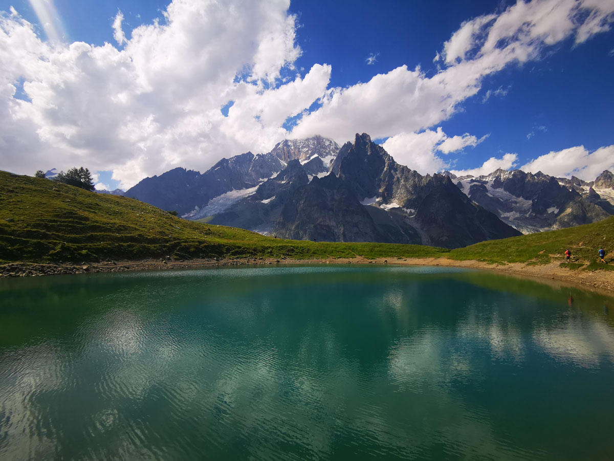
Once you reach the Maison Vielle refuge (see information on the Maison Vieille refuge) follow the signs for the Chécrouit lake, the path that goes up on the left (back to the refuge). Along the way there are several panoramic points that allow you to admire the Mont Blanc chain in all its splendour. After just under an hour’s walk you reach the lake. If you wish, you can continue along the path until you descend to Lake Combal and return along the road.
Difficulty: hiking trail
Total journey time: from the campsite to the lake 2 hours and a half (if you want to continue from Chécrouit lake to Combal lake, calculate another hour and a half, plus 30-40 minutes to La Visaille where you can take the bus or 45 minutes on foot to return to the campsite).

Departure from the campsite: take the steep path that goes up the ski slope on the edge of the wood on the right until you find a road that crosses the ski slope, turn left and continue for a short distance until you see the Refuge Monte Bianco on the right. Continue along the road that climbs up to Pré de Pascal.
Walking time: about 2 hours
Tempo di percorrenza: 2 h circa
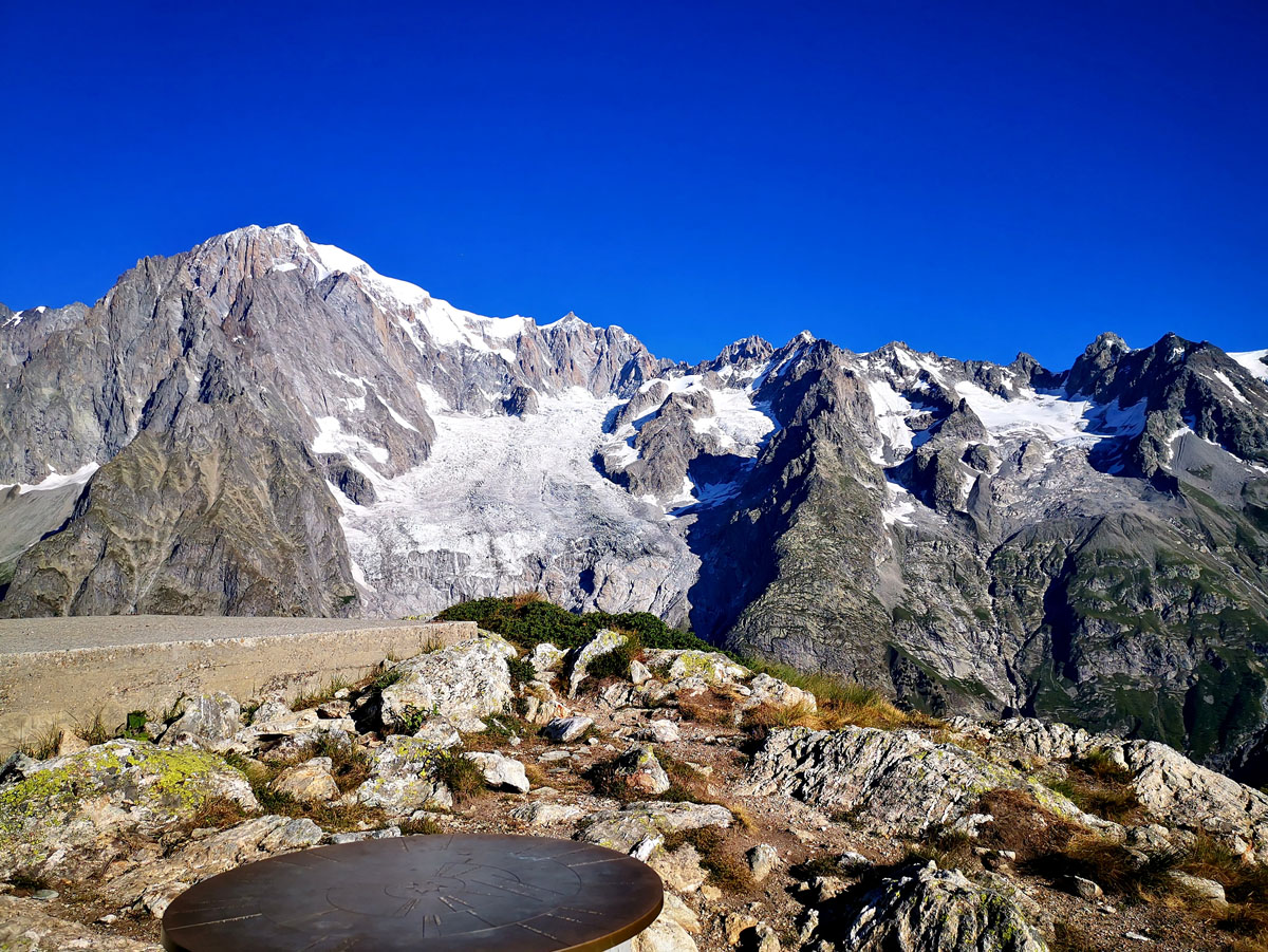
Reach Pré de Pascal on foot (there are about a couple of hours from the campsite), or get off at Courmayeur (by bicycle or bus) and take the Val Veny cable car (it is also possible to load the bicycle), then continue going up to walk the ski slope until you get to Courba Dzeleunna. From there continue with the path on the left. Along the path there are three points where you can climb: the degree of difficulty of the routes varies from 4 to 5c. Alternatively, it is also possible to climb Mont Chétif with the (easy) via ferrata which starts from Dolonne in about 3 hours.
Difficulty: hiking
Walking time: 1 hour and a half from Pré de Pascal