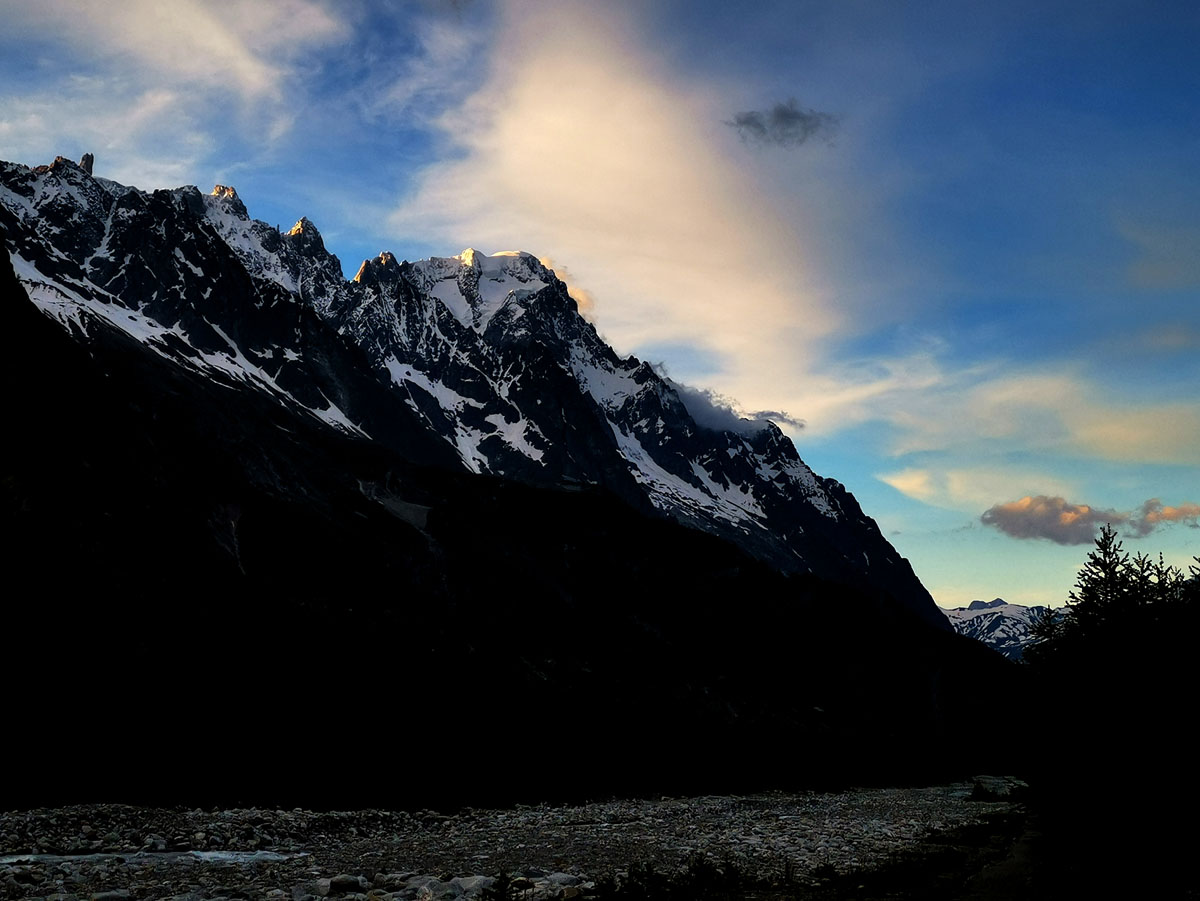
At the exit of the campsite, turn left and continue on the paved road for about 200/300 meters until you find a small car park on the right. From here begins the unpaved path along the Dora, also a mountain bike path. Continue along the river almost 1 km until you reach a large parking lot and Follow the path into the woods on the left, then follow a flat dirt road, ascending gradually, and follow it. Cross the two bridges and continue along the road until you reach a small group of houses- known as the Freney. Here you arrive at a crossroads. Stay on the right (path going down) and continue to follow the path. Follow the indications for Località La Purtud. You walk in the forest, eventually crossing a mountain stream (sometimes dry) and the La Sorgente Campground. Follow the road down stream, and reach a large white building with red doors that you found while going up in Val Veny. From there, once you have crossed the bridge, turn right and walk the paved road back to the campsite.
Difficulty: easy (flat, except for two switchbacks uphill to Le Freney)
Total length: 6.5 km
Total walking time: 1h30
Refreshments: near the Plan Veny car park, Roger Richard Pramotton bar, fountains
On leaving the campsite, turn left and follow the main road to the La Visaille bar (about 3 km). Alternatively, it is possible to take the bus (schedules displayed at reception, “La Zerotta” stop at the exit of the campsite, on the opposite side of the road, to the terminus). WARNING! Cars must be parked in the car parks near the picnic area, as there is no parking lot at La Visaille. We advise you to reach La Visaille on foot or by bus.
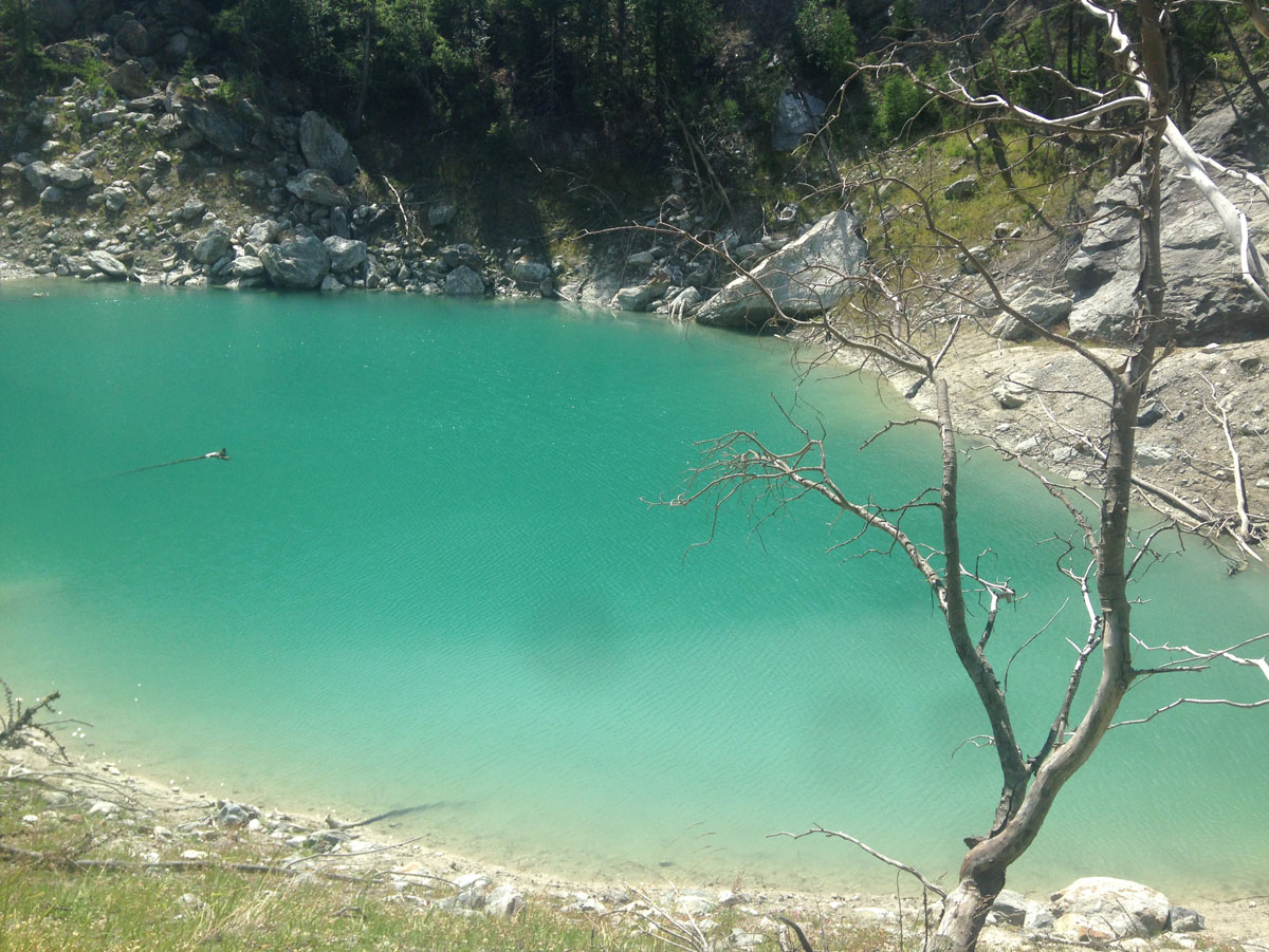
After the bar-restaurant on the right, just after a bridge, you will find signs for the Lac Vert (Jardin du Miage). Immediately cross a small stream and follow the path with clearly visible yellow signs. After about 10 minutes of walking there is an illustrative panel with the names of the summits of the Mont Blanc range indicated. Shortly after, cross a small bridge and continue to keep to the right always following the yellow marks on the stones, cross a small stream and follow the yellow marks which indicate the path to the left. Take the path that climbs until you meet a first sign indicating another 15 minutes walk. Continue until you find a post without a sign, but on which it is written to follow the path that climbs to the left to reach the lake.
Difficulty: hiking
Total journey time: 45 minutes from La Visaille
From the campsite entrance turn left and follow the main road to the La Visaille bar (about 3 km). It is also possible to take the bus (schedules displayed at reception. “La Zerotta” stop at the entrance to the campsite, on the oppositee side of the road – exit the bus at the terminus). WARNING! Cars must be parked in the car parks near the picnic area, as there is no parking at La Visaille. We advise you to reach La Visaille on foot or by bus.
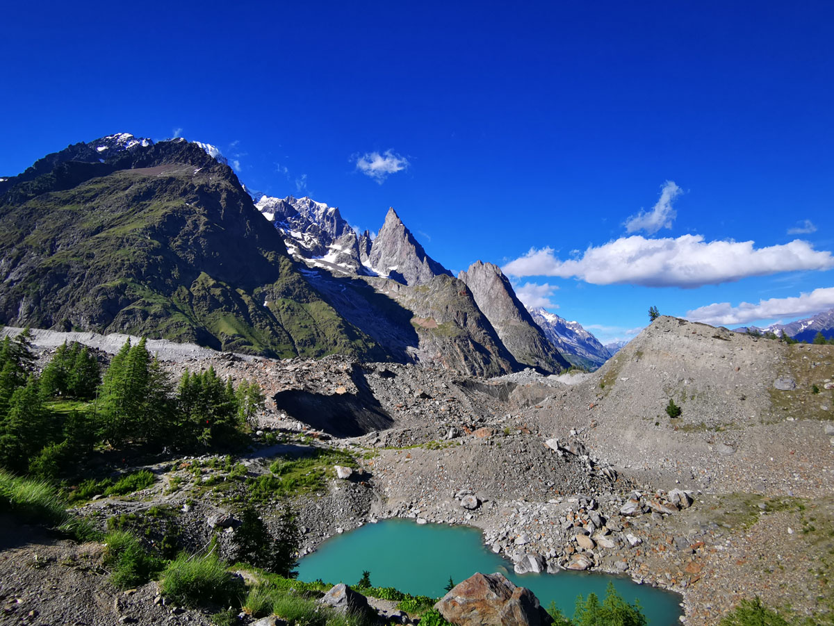
Starting from the barrier, follow the ascending road for about 1 hour to Lac Combal.
Once at Lac Combal, take the path to the right and follow it for 20 minutes to Lac du Miage. WARNING! It is a glacial lake- do not swim!!!
Difficulty: easy, hiking trail
Supplies: Cabane du Combal: 0165 1756421 or 339 6938817
Total journey time: 1h20
From the campsite entrance turn left and follow the main road to the La Visaille bar (about 3 km). It is also possible to take the bus (schedules displayed at reception. “La Zerotta” stop at the entrance to the campsite, on the oppositee side of the road – exit the bus at the terminus). WARNING! Cars must be parked in the car parks near the picnic area, as there is no parking at La Visaille. We advise you to reach La Visaille on foot or by bus.
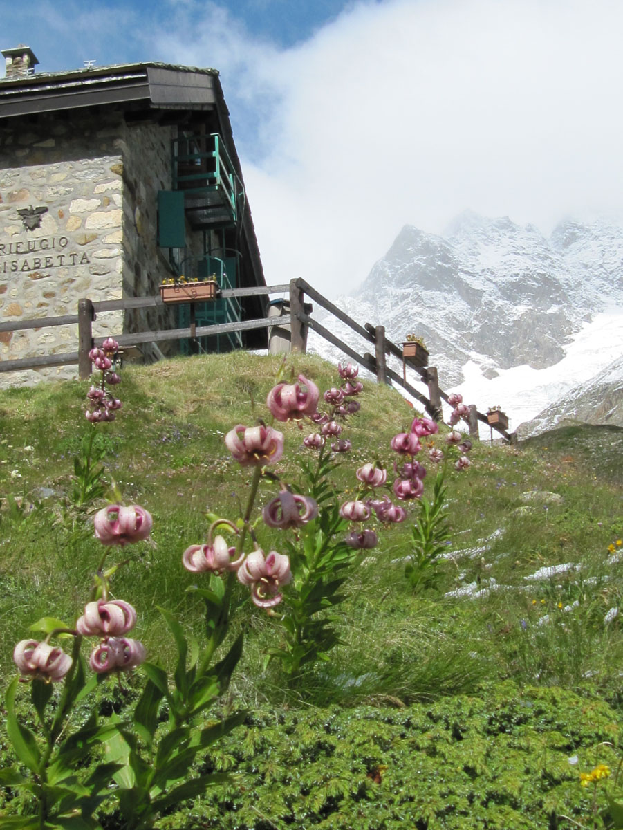
From the barrier, follow the signs for Refuge Elisabetta, ascending for 1 hour on the road to the Combal Lake, then continuing for 45 minutes on flat ground, finally climbing 20 minutes up a steep road to the hut.
This path is may also be taken by mountain bike.
WARNING! Only the first part of the path on the paved road is in the shade. The rest is exposed to the sun.
Opening period from mid-June to end of September
Telephone: 0165 844080
Difficulty: easy, hiking trail
Total walking time: 2h30
From the campsite entrance turn left and follow the main road to the La Visaille bar (about 3 km). It is also possible to take the bus (schedules displayed at reception. “La Zerotta” stop at the entrance to the campsite, on the oppositee side of the road – exit the bus at the terminus). WARNING! Cars must be parked in the car parks near the picnic area, as there is no parking at La Visaille. We advise you to reach La Visaille on foot or by bus.
From the barrier, follow the signs for Refuge Elisabetta, ascending for 1 hour on the road to the Combal Lake, then continuing for 45 minutes on flat ground, finally climbing 20 minutes up a steep road to the hut.
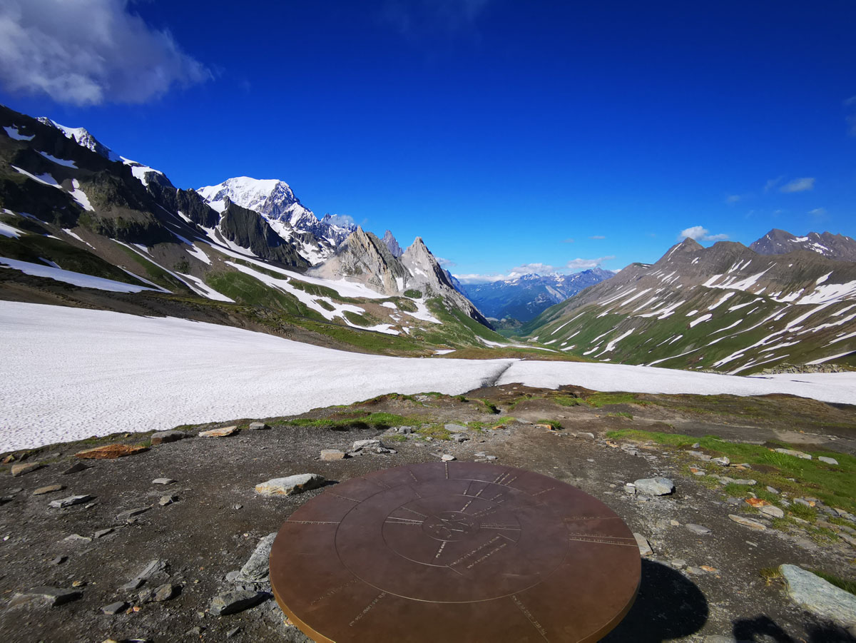
About halfway up the last section of the climb to the refuge, follow the path which curves to the left. In about an hour and a half you arrive at the Col de la Seigne, at 2515 meters, and the border between Italy and France. Along the way is an Espace Mont Blanc booth, a regional environmental awareness structure which, during the summer season, organizes awareness days (free entry; information on flora, fauna, glaciers, history, etc.) .
This path may also be traveled by mountain bike.
WARNING! Only the first part of the path on the paved road is in the shade. The rest is exposed to the sun.
Difficulty: hiking trail
Total walking time: 3h30
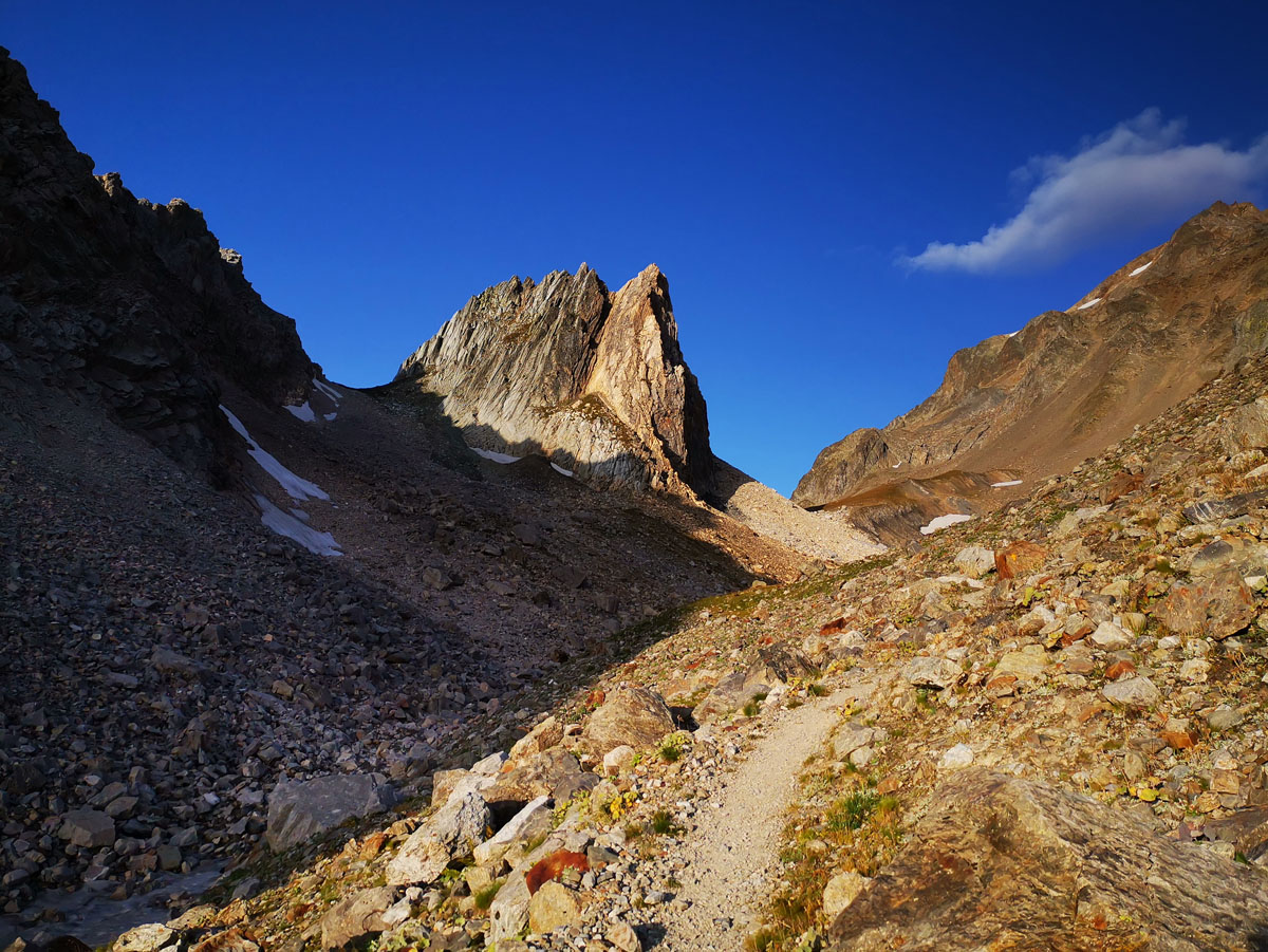
After reaching the Refuge Elisabetta, follow the path that climbs behind the refuge on the right between meadows and stony ground. After about 20 minutes you will find a crossing. Keep left and in about an hour and 15 minutes you will arrive at the Col des Pyramides Calcaires (2600m). Here are the remains of a small barracks dating from the Second World War (WARNING! For our four-legged friends there is barbed wire!). From here, follow the path that descends until you reach the TMB path (yellow signs), and turn left to continue the descent to the valley floor.
Difficulty: hiking trail
Travel time: from the Elisabetta refuge 2h30 (out and back from the hut)
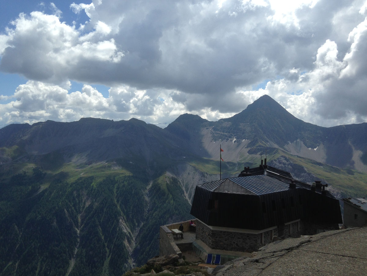
At the entrance of the campsite, turn left and follow the main road to a picnic area where the Freney parking lot is located. From here, follow the road that enters the woods, crossing two bridges. Shortly after the bridges the trail to the hut is indicated in yellow, on the left. Follow the path that climbs to the refuge- about 3 hours of walking with some via ferrata. WARNING! The path to Refuge Monzino is intended for expert hikers with the proper equipment– part of it takes place on a via ferrata, and involves ladders, cables, and steep, exposed scrambling.
Also note that overnight parking is prohibited throughout the Val Veny, so it is advisable to leave the car parked at the campsite if you wish to sleep at the refuge.
Opening period from mid-June (depending on snow) to end of August/beginning of September
Telephone: manager Armando Chanoine 3339480629, Mauro 338483909, refuge 0165809553
Difficulty: EEA (equipped expert hikers)
Total walking time: about 3 hours